The following will be the cut-off times enforced this year:
Aid Station #1: 5.11 miles (1h 45m or 8:45 a.m.)
Aid Station #2: 9.3 miles (3h 15m or 10:15 a.m.)
Finish: 14.2 miles (5h or 12:00 p.m.)
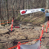
2010 McKay Hollow Madness PHOTOS
Sunday, March 21, 2010
Saturday, January 30, 2010
Sloppy Course Measurement
No, no, no. The course measurement was accurate, the course itself; a quagmire. Measured out at 14.16 miles. To those who ran this course last year, the only noticable differences in this year's route are two fold:
1) From the start to the first trail section (North Sinks Trail) is more direct, no button hook loop, just the park road directly out to the overlook and then down the barricade road right to the trail head. This change makes the first Aid Station slightly closer at 5.1 miles.
2) At the top of Natural Well trail instead of taking a left onto Arrow Head Trail, continue on Natural Well out to what we're calling S.O.B. Ditch (you'll see why if you don't know already), just across the ditch will be Aid Station #2 at 9.3 miles. After getting checked through the aid station, you'll simply turn around, re-cross the ditch and head back to the intersection of the Natural Well trail and Arrow Head trail. Right onto the Arrow Head trail and from here the rest of the course is the same as last year.
Sunday, November 29, 2009
2010 Course Map

Essentially the same route as last year with two exceptions:
1) More direct way off the mountain at the start.
2) Added a short out and back section to a SECOND full service aid-station near the washout (a.k.a. S.O.B. Ditch) on the Natural Well Trail (close to Monte Sano Blvd).
These changes necessitated lengthening the course to around 14 miles. The MHM race magagement strongly feels that these changes will improve the quality and safety of the race for all participants without making the course significantly more difficult.
So Aid Station#1 = 5.1 Miles, Aid Station #2 = 9.3 Miles.
Map Legend:
Yellow Circles = Aid Stations
Black Circles = Start/Finish Line
Blue Line = First "half" of the course
Red Line = Second "half" of the course
Purple Line = Out and back section between course "halves."
Subscribe to:
Posts (Atom)


