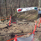

Essentially the same route as last year with two exceptions:
1) More direct way off the mountain at the start.
2) Added a short out and back section to a SECOND full service aid-station near the washout (a.k.a. S.O.B. Ditch) on the Natural Well Trail (close to Monte Sano Blvd).
These changes necessitated lengthening the course to around 14 miles. The MHM race magagement strongly feels that these changes will improve the quality and safety of the race for all participants without making the course significantly more difficult.
So Aid Station#1 = 5.1 Miles, Aid Station #2 = 9.3 Miles.
Map Legend:
Yellow Circles = Aid Stations
Black Circles = Start/Finish Line
Blue Line = First "half" of the course
Red Line = Second "half" of the course
Purple Line = Out and back section between course "halves."


